Great Smoky Mountains National Park: Guide & Itineraries
National Park Service / Wikimedia Commons (Public Domain)
State
North Carolina / Tennessee
Best season
Fall
Entrance fee
Free (parking tag $5/day at most trailheads)
The most visited national park in the United States — and the only major one with no entrance fee — spanning 522,000 acres of ancient Appalachian forest across the Tennessee–North Carolina border.
Great Smoky Mountains National Park protects the oldest mountains in North America — worn down over hundreds of millions of years to the rounded, forested ridges visible today. The park is a UNESCO World Heritage Site recognized for its biological diversity: more tree species than all of northern Europe combined, around 1,500 black bears, and one of the most intact eastern deciduous forests remaining.
The name comes from a characteristic blue-grey haze that settles in the valleys — water vapor and naturally occurring terpenes released by the dense tree cover. The park has two main gateways: Gatlinburg, Tennessee on the north side and Cherokee, North Carolina on the south, connected by Newfound Gap Road (US-441) — the only paved road crossing the mountains.
Two itinerary options share the same Day 1 and Day 2. The 2-Day Plan covers Cades Cove wildlife and the Alum Cave / Clingmans Dome corridor. The 3-Day Plan adds the Roaring Fork Motor Nature Trail and old-growth forest near Gatlinburg.
Day 1: Cades Cove Wildlife Loop
Start: Sugarlands Visitor Center, Gatlinburg. Main attraction: Cades Cove 11-mile loop road. Best for wildlife: Arrive at the cove entrance before 8am. Afternoon hike: Abrams Falls (5 mi round-trip).
| # | From → To | Mode | Distance / Time | Notes |
|---|---|---|---|---|
| 1 | Sugarlands VC → Cades Cove entrance | Drive | 25 mi / 40 min | Drive Laurel Creek Road west; arrive before 8am for wildlife |
| 2 | Cades Cove Loop — first half | Drive (slow) | 5.5 mi / 1–2 hrs | John Oliver Cabin, Primitive Baptist Church, open meadow; stop at every wildlife pullout |
| 3 | Cades Cove Loop — midpoint to end | Drive (slow) | 5.5 mi / 1–2 hrs | Missionary Baptist Church, Cable Mill historic area; black bear sightings most common here |
| 4 | Abrams Falls Trailhead | Hike | 5 mi round-trip / 2.5 hrs | Moderate trail through forest to a wide 20-ft waterfall; swimming hole at base |
| 5 | Return to Gatlinburg | Drive | 25 mi / 40 min | Same Laurel Creek Road back; different light in late afternoon |
Map tiles © OpenStreetMap contributors
Morning (7:00am – 12:00pm)
- 7:00am — Sugarlands Visitor Center: Stop briefly for current conditions and any wildlife activity reports from rangers. The drive to Cades Cove takes 40 minutes via Laurel Creek Road.
- 7:45am — Cades Cove entrance: An 11-mile one-way loop road through a broad open valley surrounded by forested ridges. Early morning is by far the best time — deer and black bears feed in the meadows before the day's heat, and vehicles are few enough to stop anywhere without blocking traffic. The first section passes the John Oliver Cabin (circa 1820), one of the most intact early homesteads in the park.
- 9:00am — Midpoint meadows: The middle section of the loop, near the Missionary Baptist Church, typically produces the most wildlife sightings. Black bears regularly emerge from the treeline here, sometimes with cubs in spring and early summer. The open meadow extends for half a mile — scan the entire edge slowly. Coyotes, wild turkey, and white-tailed deer are common; red foxes occasional.
- 10:30am — Cable Mill: Near the end of the loop, a working 19th-century gristmill demonstrates corn grinding on weekends. The historic structures here include a blacksmith shop and several farm buildings, all original to the pre-park farming community.

Afternoon (12:00pm – 5:00pm)
- 12:00pm — Lunch at Cable Mill Picnic Area: Pack lunch — there are no food concessions inside Cades Cove. The picnic area near the Cable Mill is pleasant and shaded.
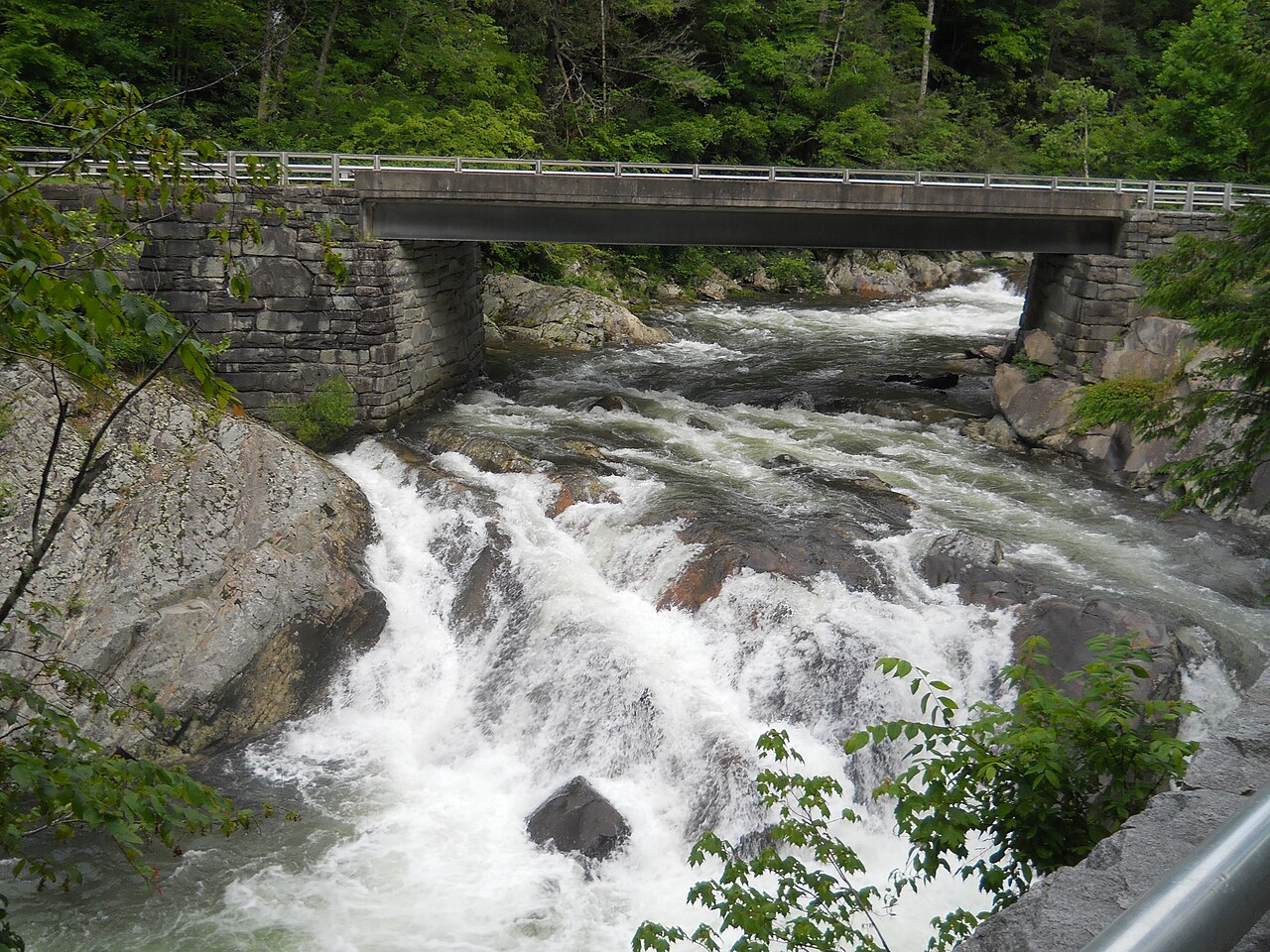
- 1:00pm — Abrams Falls Trail: Trailhead near the end of the Cades Cove loop (follow signs past the Cable Mill). The 5-mile round-trip hike descends to Abrams Creek through mixed forest with several creek crossings. The falls are 20 feet high and 100 feet wide — the wide cascade creates a swimming hole at the base. The trail is rated moderate; the creek crossings require some boulder-hopping.
- Closed mornings: Cades Cove is closed to vehicles on Wednesday and Saturday mornings until 10am — those mornings are reserved for cyclists and walkers. If visiting on those days, arrive by bike or on foot for a very different (and much quieter) experience.

Day 2: Alum Cave Trail + Clingmans Dome
Start: Alum Cave Trailhead on Newfound Gap Road. Hike: 4.4 mi round-trip to the Bluffs (or 11 mi to LeConte Summit). Afternoon: Newfound Gap overlook + Clingmans Dome (spur road open April–November).
| # | From → To | Mode | Distance / Time | Notes |
|---|---|---|---|---|
| 1 | Gatlinburg → Alum Cave Trailhead | Drive (Newfound Gap Road) | 9 mi / 20 min | Start by 8am; trailhead parking fills by 9am on weekends |
| 2 | Trailhead → Arch Rock | Hike | 1.4 mi / 50 min | Old-growth hemlock forest; Alum Cave Creek alongside the trail |
| 3 | Arch Rock → Alum Cave Bluffs | Hike | 0.8 mi / 40 min | Overhanging cliff with mineral deposits; turnaround point for most day hikers |
| 4 | Alum Cave Bluffs → Newfound Gap | Drive | 5 mi / 12 min | 5,046 ft elevation; Appalachian Trail crosses the road; TN-NC state line |
| 5 | Newfound Gap → Clingmans Dome | Drive (spur road) | 7 mi / 20 min + 0.5 mi walk | 6,643 ft summit; open April–November; steep paved trail to observation tower |
Map tiles © OpenStreetMap contributors
Morning (7:30am – 1:00pm)
- 7:30am — Alum Cave Trailhead: Widely considered the park's best mid-difficulty hike. Start early — the parking lot fills by 9am on weekends. The trail begins in old-growth hemlock and hardwood forest alongside Alum Cave Creek.
- 8:20am — Arch Rock: A natural tunnel formed by the freeze-thaw expansion of water in the rock. The trail passes directly through the narrow opening. The formation is about 1.4 miles from the trailhead and signals the transition to more exposed terrain above.
- 9:00am — Alum Cave Bluffs: A large overhanging cliff formation at 2.2 miles — not a cave, despite the name, but a concave alcove 500 feet long, draped with mineral deposits including alum, Epsom salts, and saltpeter. Water drips continuously from the overhang. This is the recommended turnaround for most day hikers (4.4 miles round-trip, approximately 1,000 feet of gain). For committed hikers: continuing to Mt. LeConte summit adds 6.6 more miles and another 2,500 feet of gain — allow a full day and bring extra food and water.
- 11:30am — Return to trailhead.

Afternoon (1:00pm – 5:00pm)
- 1:00pm — Newfound Gap: Drive 5 miles south on Newfound Gap Road to the 5,046-foot pass at the Tennessee-North Carolina state line. The Appalachian Trail crosses the road here — hikers with heavy packs are usually visible. A stone monument marks the state boundary. Short walks in either direction sample the high-elevation spruce-fir forest, a zone that feels distinctly northern in character compared to the lower hardwood forest.
- 2:00pm — Clingmans Dome: Turn onto the 7-mile spur road (open April–November) to the park's highest point at 6,643 feet — the third-highest peak east of the Mississippi. A steep half-mile paved trail (accessible; very strenuous) leads to a spiral observation tower. On clear days, visibility exceeds 100 miles. On overcast days, the tower emerges above the cloud layer into open sky — a different but equally spectacular experience. The spruce-fir forest at this elevation is severely stressed by an invasive insect (balsam woolly adelgid); many standing dead trees are visible throughout the summit zone.

Day 3: Roaring Fork Motor Nature Trail (3-Day Plan)
Start: Gatlinburg. Route: Roaring Fork Motor Nature Trail — a 5.5-mile one-way historic road through old-growth forest. Hike: Grotto Falls (2.6 mi round-trip). Season: Open spring through fall; closed in winter.
| # | From → To | Mode | Distance / Time | Notes |
|---|---|---|---|---|
| 1 | Gatlinburg → Roaring Fork entrance | Drive | 2 mi / 10 min | Follow Airport Road through Gatlinburg; no RVs, trailers, or motor homes |
| 2 | Roaring Fork entrance → Grotto Falls TH | Drive (slow, one-way) | 2 mi / 15 min | Multiple roadside waterfall pullouts; Place of a Thousand Drips seasonal waterfall |
| 3 | Grotto Falls Trail | Hike | 2.6 mi round-trip / 1.5 hrs | 25-ft falls with a walkable path behind the curtain; hemlock forest |
| 4 | Continue Roaring Fork Road | Drive | 3.5 mi / 20 min | Ephraim Bales and Alfred Reagan historic cabins; ends near Cherokee Orchard |
Map tiles © OpenStreetMap contributors
Morning (8:00am – 12:00pm)
- 8:00am — Roaring Fork Motor Nature Trail: Access from Gatlinburg via Airport Road. The road is a narrow, one-way loop through old-growth forest, following Roaring Fork Creek. No RVs or vehicles with trailers can navigate the tight curves — this keeps it significantly less crowded than Cades Cove. The road is closed in winter (typically November–March).
- 8:20am — Place of a Thousand Drips: A seasonal roadside waterfall where dozens of small streams converge on a moss-covered rock face. Spectacular after rain or in late spring; minimal in dry summer months. Pull off and walk the short path to the base.
- 9:00am — Grotto Falls Trail: A 2.6-mile round-trip hike through hemlock forest to a 25-foot waterfall — one of only a few in the park where the trail passes directly behind the water curtain. The path is maintained and well-marked. The forest around the trail is among the most intact old-growth hemlock in the southern Appalachians.

Afternoon (12:00pm – 4:00pm)
- 12:00pm — Continue the motor trail: The second half of the one-way road passes several historic cabin sites, including the Ephraim Bales Cabin and the Alfred Reagan Place — a farmstead with a restored tub mill, grist mill, and blacksmith shop. The Roaring Fork Creek is visible and audible throughout, rushing beside the narrow road.
- 1:00pm — Cherokee Orchard area: The trail exits near Cherokee Orchard Road back toward Gatlinburg. The orchard itself was planted by the pre-park Cherokee community and then managed commercially before the park's establishment in 1934.
- Seasonal alternatives for Day 3:
- Fall (October): Drive the Blue Ridge Parkway east from Cherokee, NC — one of the most scenic fall foliage drives in the eastern US. Peak color is typically the second or third week of October.
- Late May: The synchronous firefly event at Elkmont Campground. Thousands of fireflies (Photinus carolinus) flash in coordinated patterns — one of the rarest natural events in North America. Requires a parking lottery through recreation.gov, typically opening in April.
- Spring (April–June): Wildflower trails near Gatlinburg; the Porters Creek Trail is known for outstanding trillium and trout lily displays in late April.
Key Highlights
- Cades Cove — 11-mile wildlife loop through a historic valley. Best before 8am for bears, deer, and turkey. Closed to vehicles Wed/Sat mornings until 10am.
- Alum Cave Trail — Park's best mid-difficulty hike; old-growth forest, Arch Rock, and the mineral-stained Bluffs. 4.4 mi round-trip.
- Clingmans Dome — Highest point in the park (6,643 ft); panoramic views to 100 miles on clear days. Open April–November.
- Roaring Fork Motor Nature Trail — 5.5-mile one-way scenic road with waterfalls and historic cabins. No RVs; closed in winter.
- Synchronous fireflies — Late May at Elkmont; parking lottery required. One of the rarest wildlife spectacles in North America.
- Fall foliage — Peak color typically the second and third weeks of October. The park is one of the most biodiverse fall-color landscapes in the eastern US.
Planning Notes
- Entrance fee: The park has no admission fee. A parking tag ($5/day) is required at most trailheads — purchase at self-service kiosks or via the NPS app before arrival.
- Crowds: The park receives 12+ million visitors annually — more than any other US national park. Summer and peak fall foliage weekends (mid-October) are the busiest. Weekday visits and early morning starts significantly reduce congestion.
- Black bears: Around 1,500 black bears live in the park. Food storage is mandatory at all campsites. Never approach or feed bears — maintain at least 50 yards distance at all times.
- Synchronous fireflies: Two weeks in late May at Elkmont Campground. Parking lottery at recreation.gov, typically opening in April. A legitimate bucket-list experience if the dates align with your visit.
- LeConte Lodge: The only hike-in lodge in the eastern US, at the summit of Mt. LeConte. Reservations open October 1 for the following year and sell out within hours.
Keep exploring

Grand Canyon National Park: Complete Visitor Guide & Itineraries
277 miles long, up to 18 miles wide, and over a mile deep — the Grand Canyon is one of the most visited natural landmarks in the world and one of the best preserved geological records on Earth. This guide covers rim viewpoints, inner-canyon hikes, 1- to 3-day itineraries, and detailed route planning for first-time visitors.

Yellowstone National Park: Guide & Itineraries
The world's largest geothermal area, a supervolcano caldera, and one of North America's best wildlife corridors — all in one park spanning 3,500 square miles across Wyoming, Montana, and Idaho.

Yosemite National Park: Guide & Itineraries
A glacially carved granite valley in the Sierra Nevada, home to some of North America's tallest waterfalls, sheer rock faces that define modern climbing, and one of the largest groves of ancient giant sequoias.